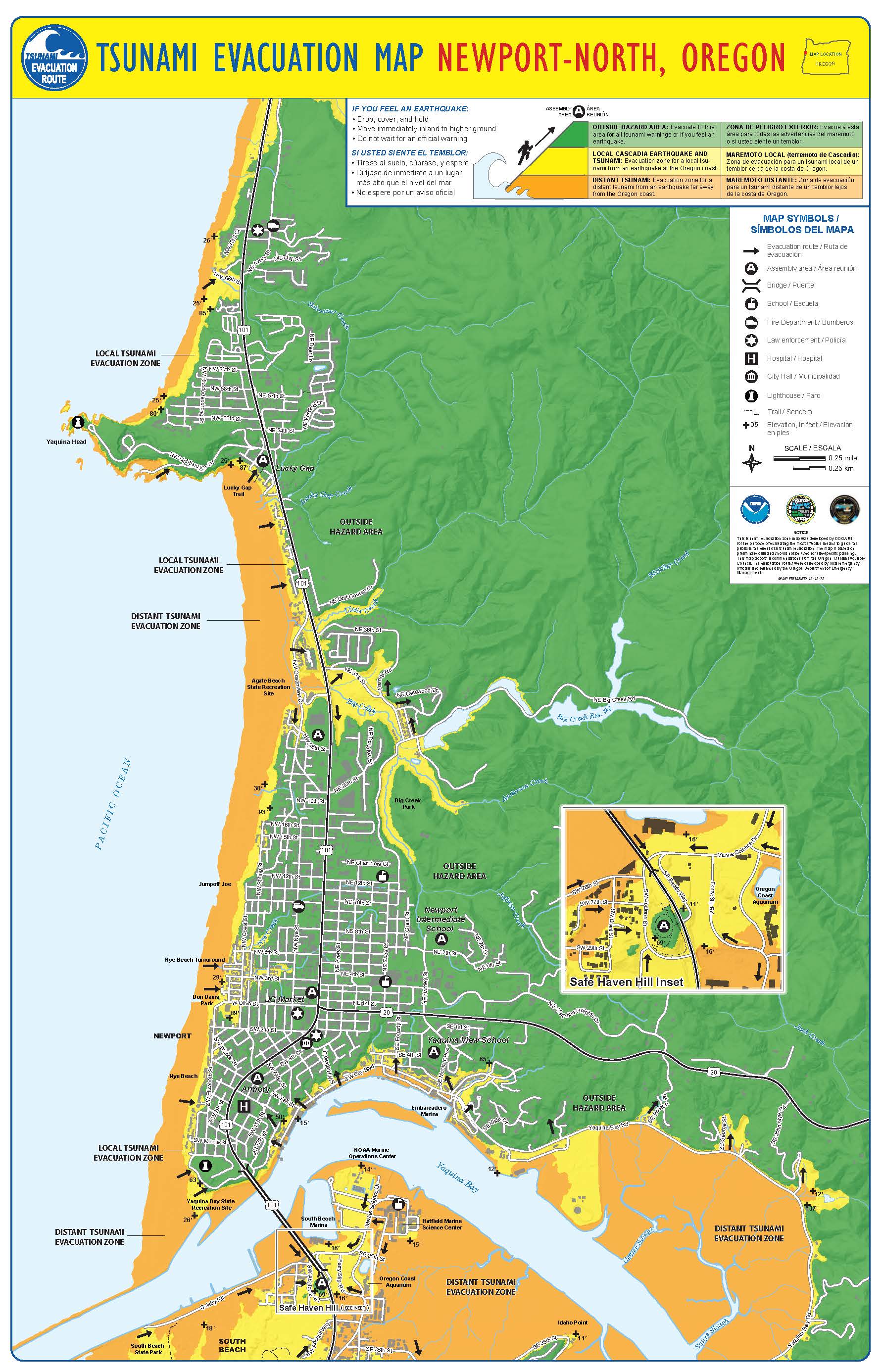
Evacuation Map - North Newport
Knowing your evacuation routes before an emergency can save lives. The North Newport Evacuation Map shows designated routes and assembly areas for residents and visitors located in the northern parts of the city.
In the event of a tsunami or other evacuation event, follow the marked routes to reach safe locations on higher ground. Evacuation routes are marked by blue and white tsunami signs throughout the community.
North Newport Assembly PointsIf you evacuate, proceed to one of these designated assembly areas:
- Lucky Gap Trail next to Roby's Furniture
- Walmart Parking Lot
- Newport Intermediate School
- McKay's Parking Lot
- Yaquina View Elementary School
- National Guard Armory
What to Do During an Evacuation
- Move quickly to your nearest assembly area.
- Do not wait for official instructions if you feel strong shaking or see rapid water withdrawal; evacuate immediately.
- Take your emergency kit if it is readily available.
- Plan ahead to know which route is closest to your home, workplace, or lodging.
To view the full map and download a copy, visit the City of Newport’s evacuation resources page or use the link below.
Download the North Newport Evacuation Map